lunes, 4 de septiembre de 2017

Put Bookmarks to Work in Your ArcGIS Pro Projects

Put Bookmarks to Work in Your ArcGIS Pro Projects

By Hannah Deindorfer
Documentation Project Engineer, Esri

You likely have a browser full of bookmarked web pages, making the information you most often need to retrieve right at your fingertips.
Bookmarks can be just as helpful when used in ArcGIS Pro. There are some cool tools in ArcGIS Pro that will give you the ability to convert bookmarks to animations and create bookmarks at certain points in time.
Bookmarks will save you precious time when you are working on a project. You can create spatial bookmarks at locations on a map and go back to them at any time. For example, if you have a large map and several small study areas on the map, you can save time panning and zooming to those areas by creating a bookmark at each location. Or if you are giving a presentation with ArcGIS Pro (like a demo), bookmarks come in very handy for saving your place and transitioning smoothly between places on the map.
The bookmark captures and saves your current view extent. When you create a bookmark in ArcGIS Pro, it is added to a list, given a unique thumbnail and name, and saved with the 2D map or 3D scene you captured it in. A project contains a list of all the bookmarks saved with all open maps in that project.
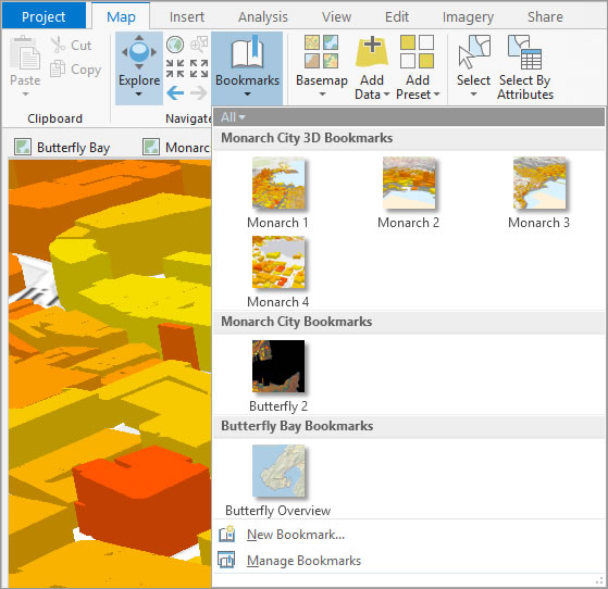
Use bookmarks to save your favorite or frequently used map extents. They're stored with a title and thumbnail on the Bookmarks drop-down menu.
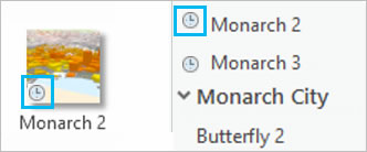
In ArcGIS Pro, bookmarks can also be temporal. If you have time-enabled data, you can create bookmarks at specific points in time. For example, if you have data that tracks the migration of monarch butterflies across North America, you can create a bookmark showing the butterflies' location midmigration and return to it anytime. Temporal bookmarks display with a clock icon that appears both in the thumbnail and next to the bookmark name in a list view.
Create and use bookmarks

Step 1. Pan or zoom to the location or time that you want to bookmark.
Step 2. On the Map tab, click the Bookmarks drop-down menu, and click New Bookmark.
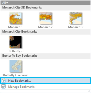
Step 3. Type a name for your bookmark, then click OK.
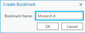
Step 4. Click the Bookmarks button to see your new bookmark and other bookmarks you've created in that map or other open maps in the project.
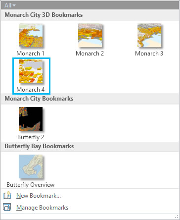
Step 5. Click any of the thumbnails on the Bookmarks menu to go to that location.

Use the Bookmark Manager

If you want to modify your bookmarks, open the Bookmarks pane. On the Map tab, click the Bookmarks drop-down menu and click Manage Bookmarks.
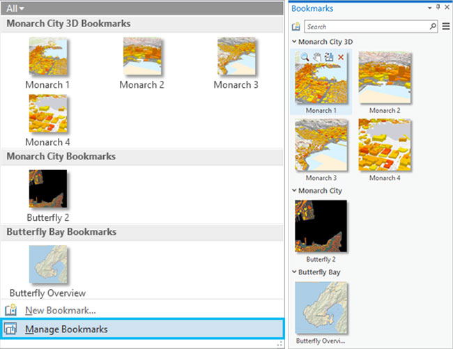
In the Bookmarks pane, you can do any of the following:
  • Reorganize your bookmarks list
  • Update the location of a bookmark by clicking the Update button
  • Create new bookmarks
  • Rename or delete bookmarks

Create an animation with bookmarks

Animations are a great way to tell the story of your 2D and 3D maps. Check out this awesome video of animations to quickly see how powerful they can be in displaying and conveying information.
You can use your bookmarks to create an animation.
  1. On the ribbon, click the View tab and click Add to access the Animation tab.
  2. In the Create group, click Import and choose Bookmarks to Fly-Through or Bookmarks to Tour.
Watch this short video on how to convert bookmarks to animation.

Sea Turtle App Turns Tourists into Citizen Scientists

Sea Turtle App Turns Tourists into Citizen Scientists

Researcher Easily Built His First App by Using AppStudio for ArcGIS


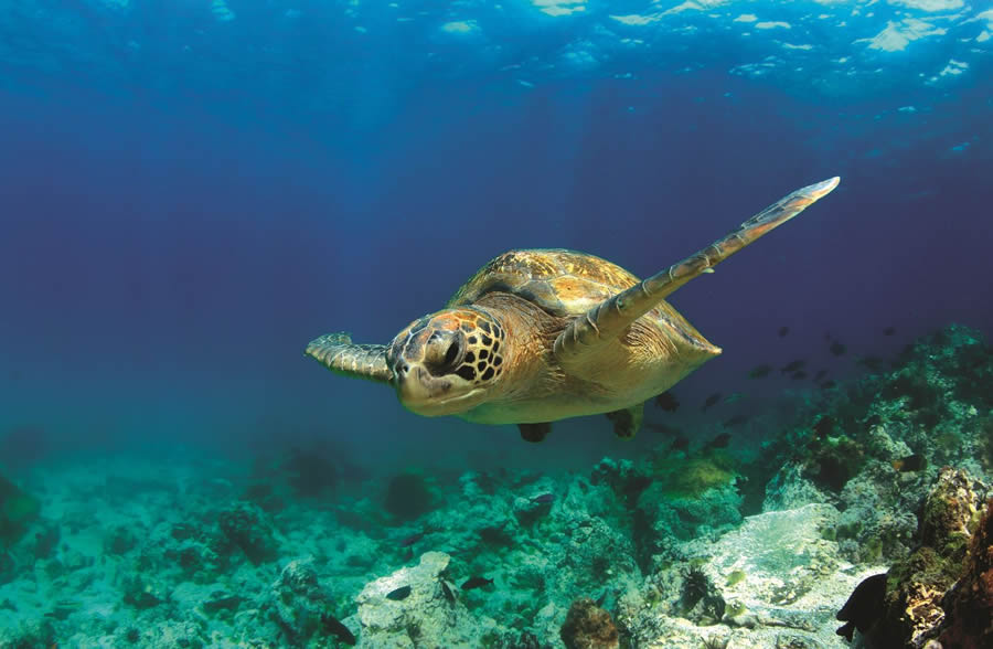
A sea turtle swims past schools of fish.
Snorkelers, scuba divers, and beachgoers who spot sea turtles can help scientific researchers learn more about the elusive and often endangered marine reptiles.
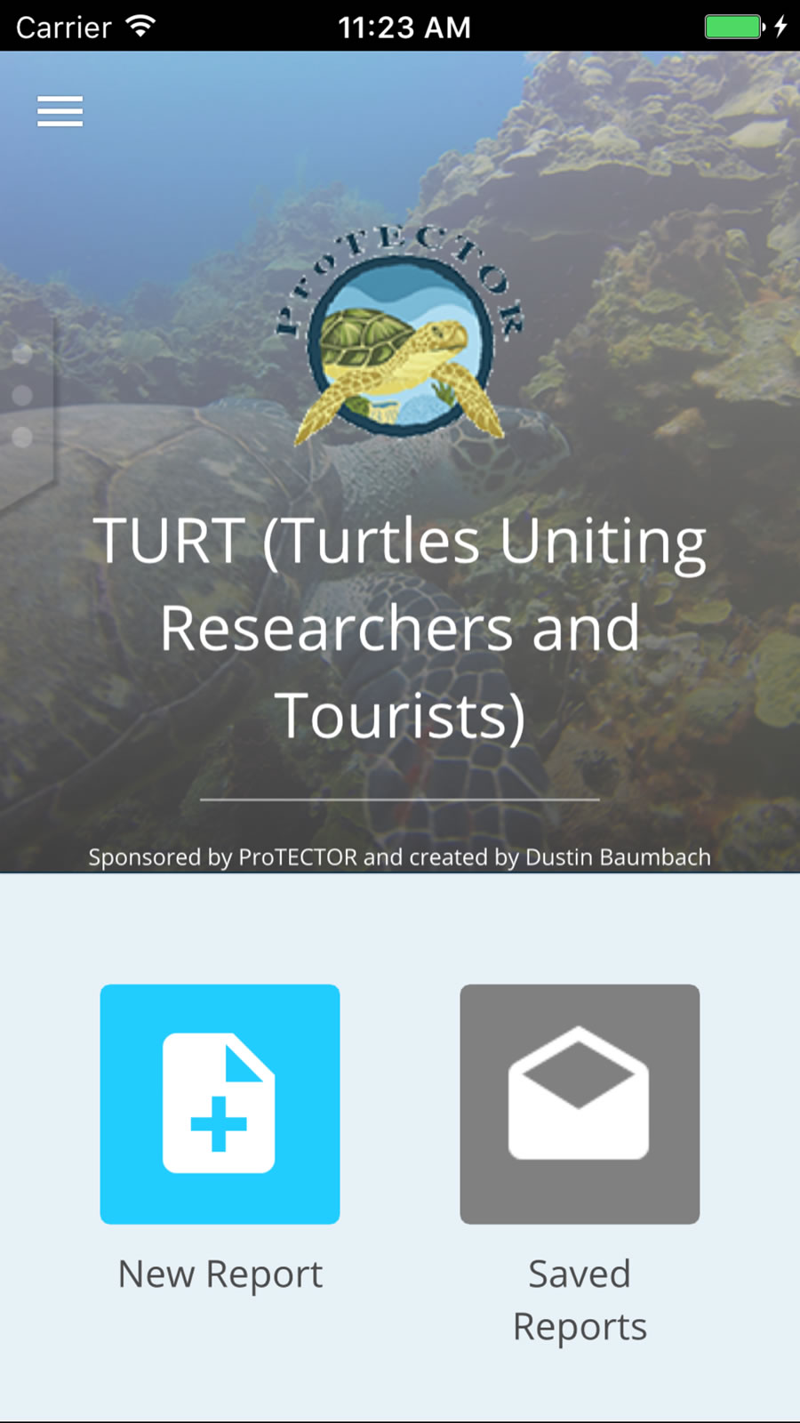
All they need to do is download an app called TURT (Turtles Uniting Researchers and Tourists) onto their smartphone before they hit the beach or go out on the water. The app is available on iOS and Android.
Dustin Baumbach, a PhD student and marine researcher at Loma Linda University in California, built TURT using AppStudio for ArcGIS, which Esri developed to help users create mobile mapping apps quickly. The mapped data from TURT is available for sea turtle research, including the work being done by the non-profit Protective Turtle Ecology Center for Training, Outreach and Research, Inc., (ProTECTOR).
"Data uploaded by scientists and citizen scientists [will] help our research by mapping out locations of turtles to help us track population numbers within countries and, through the help of photo identification (photo ID), track individuals on a global scale," Baumbach said.
Loma Linda University PhD student and researcher Dustin Baumbach used AppStudio for ArcGIS to build TURT.
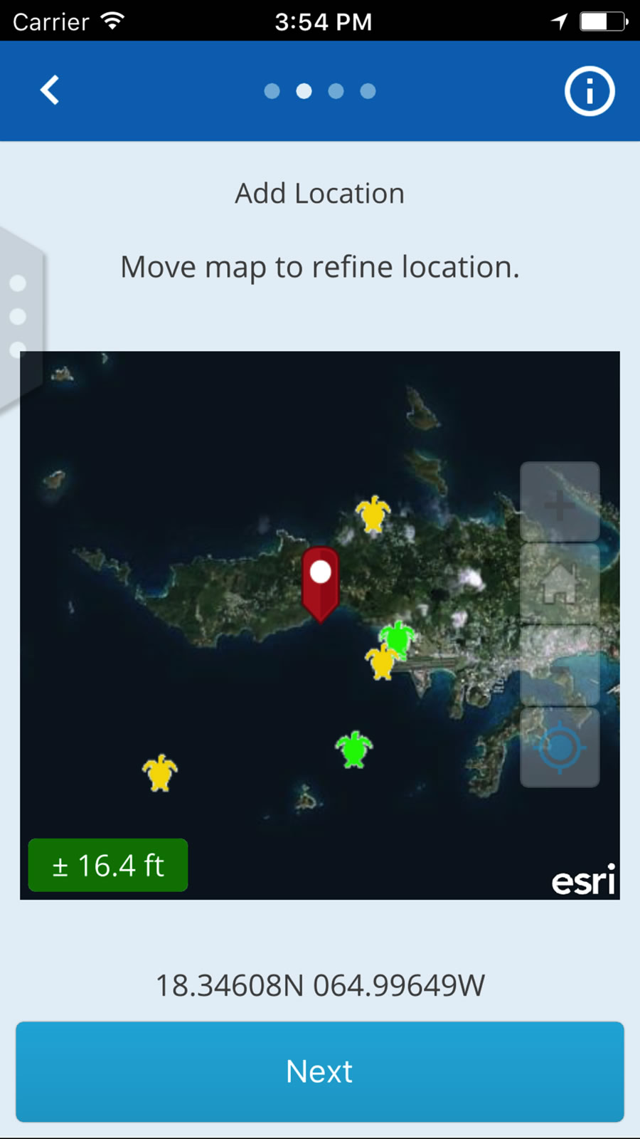
The TURT app lets you map the location of your sea turtle sighting.
Today in places such as the US Virgin Islands, Honduras, and Hawaii, sea turtles can frequently be spotted swimming along ocean currents or crawling onto beaches to lay their eggs.
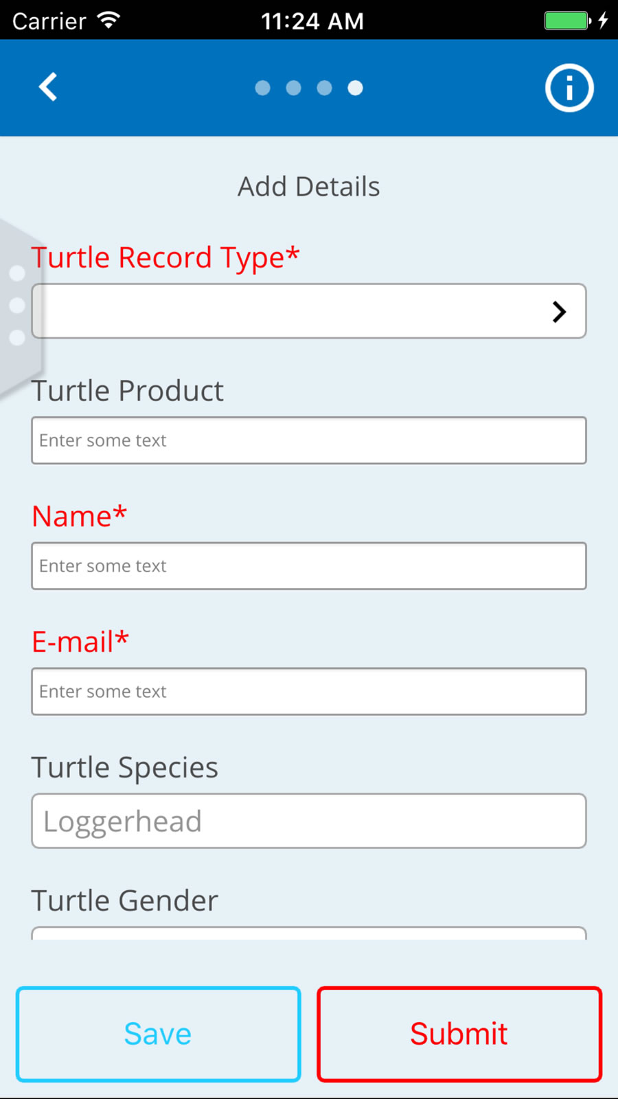
When TURT app users see a sea turtle, they can snap a photo of the marine reptile; add its location on a map; choose from a list to indicate the type of turtle—for example, Hawksbill, Loggerhead, or Olive Ridley—they spotted; and type in some details such as the weather conditions, depth of the ocean, and time of day and date of the sighting.
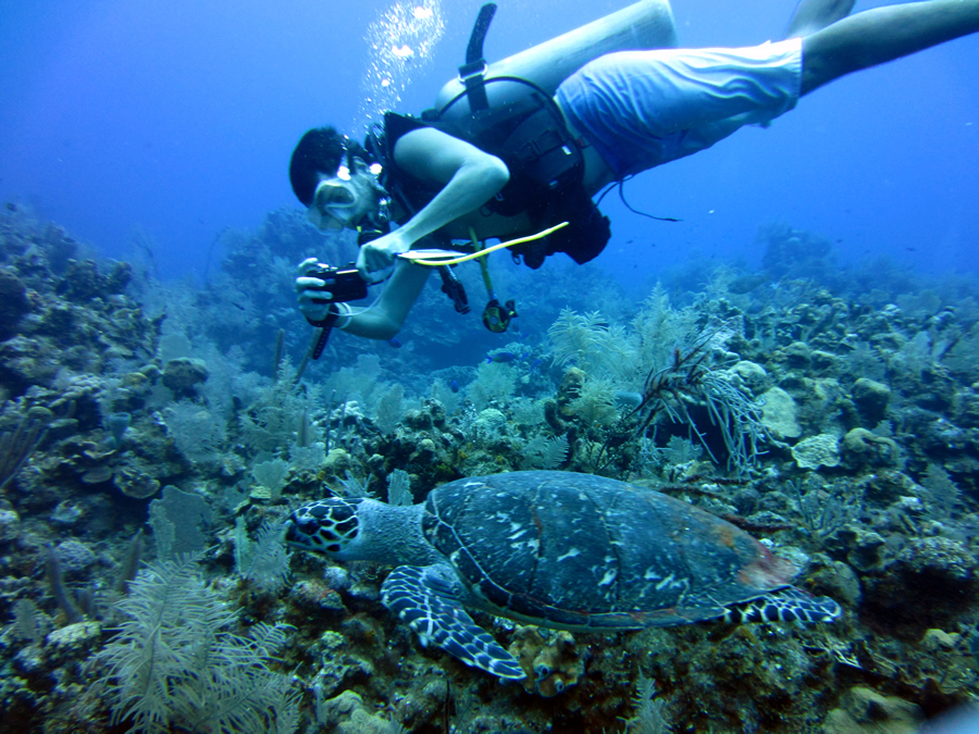
Baumbach photographs a sea turtle in the ocean off Honduras. Photo by Dr. Floyd Hayes.
Once data is added to the TURT app, it is automatically and instantaneously uploaded to a global sea turtle database via a web map stored in Esri ArcGIS Online. Researchers and conservationists use the information to analyze trends and hot spots to assess the distribution, health, and migration activities of the various sea turtle species.
TURT turns tourists into citizen scientists, reporting on creatures that have cruised the oceans for 100 million years. The information people collect is important, because nearly all the seven species of marine reptiles are now classified as endangered, according to the National Oceanic and Atmospheric Administration (NOAA).
Baumbach worked on the TURT project with Stephen Dunbar, a professor in the Loma Linda University School of Medicine's department of earth and biological sciences. Dunbar has been studying sea turtles for 10 years in places such as the Caribbean Sea and Honduras. Baumbach joined Dunbar in his research for two summers, which prompted the idea for a smartphone app that would assist sea turtle conservation researchers.
"Researchers are not able to be at their field site all year long, but divers are there every day," Baumbach said. "Sea turtles are a critically endangered species, and this app can help conserve them while also educating other researchers and the public."
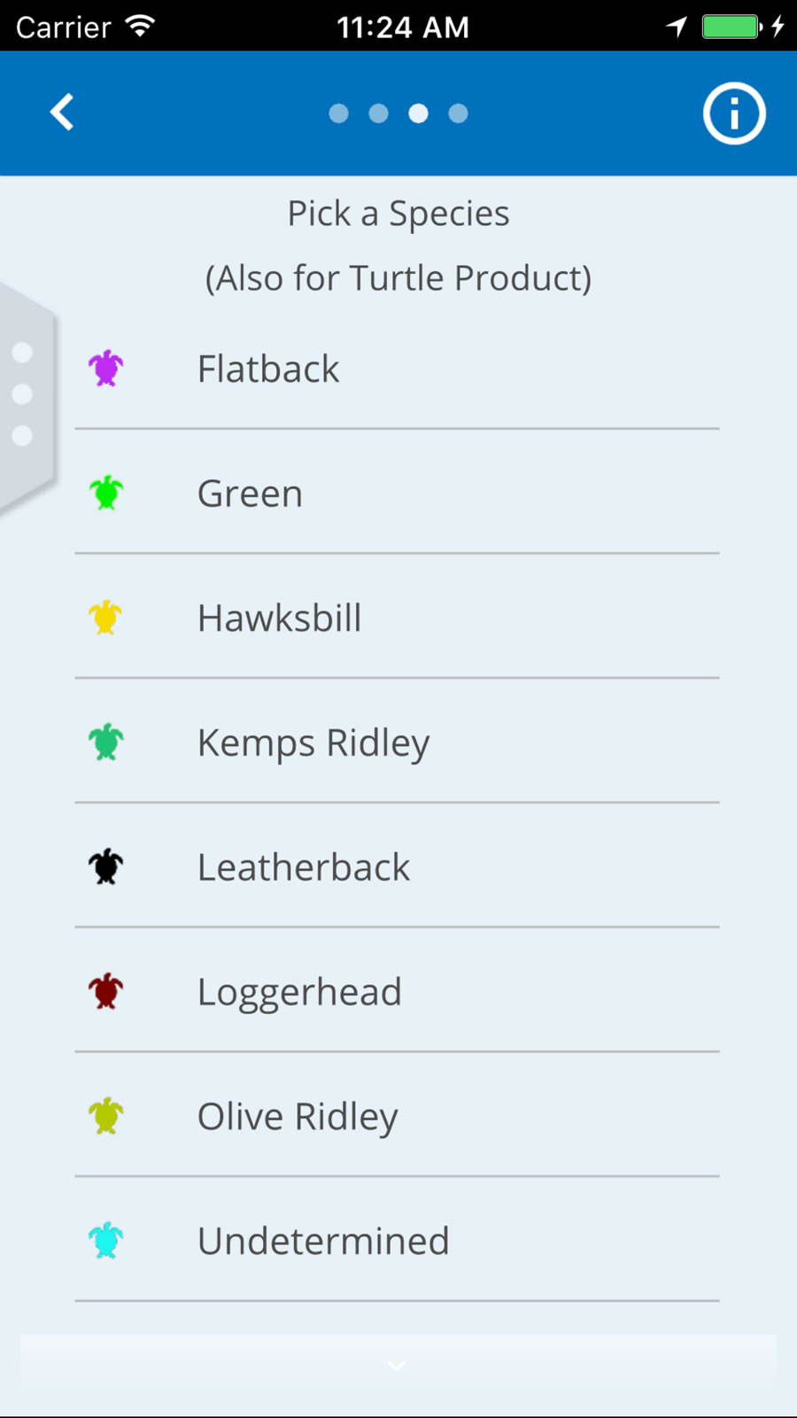
The app lets you select the species of turtle that you spotted.
Once information is uploaded to the TURT app, it is automatically and instantaneously inserted into a global sea turtle database.
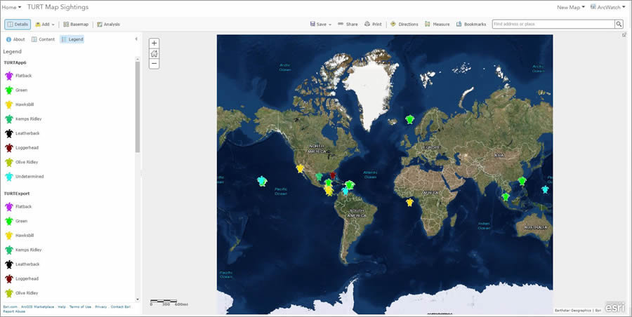
A map is available to ArcGIS Online users that shows all the turtle sightings collected by the app's users.
This map, available to view in ArcGIS Online, shows the sea turtle species and locations of sightings that have been documented by the TURT app users around the world.
To build TURT, Baumbach selected AppStudio for ArcGIS because it allowed him to create a consumer-friendly mobile app that works with Android, iOS, Windows, Mac OS X, and Linux. The app can be used in offline mode, so divers in remote areas without cell phone coverage can still record sightings. Moreover, using AppStudio for ArcGIS let Baumbach publish TURT in app stores, using his own brand. In this case, he employed branding from ProTECTOR, Dunbar's nonprofit organization.
"I had never made an app before, but AppStudio was very simple to use," Baumbach said. "I downloaded the app, put all my info into the Quick Report template, and then customized it using the AppStudio language. Being able to deploy the app across platforms is a big benefit. And it's good that we can brand it through our organization."
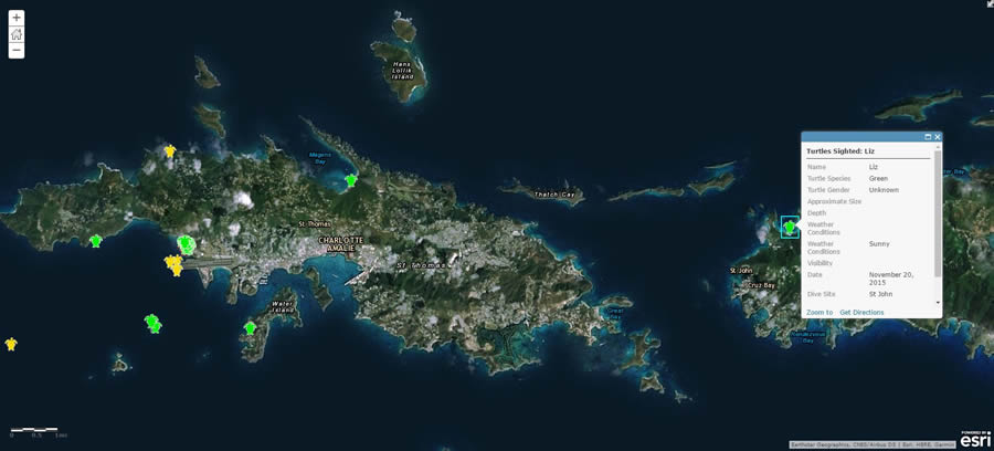
A pop-up provides details of a sea turtle sighting on the island of Saint John, U.S. Virgin Islands.
Baumbach and Dunbar have started promoting the app to dive operators around the world, with a focus on the Caribbean, Thailand, Malaysia, Australia, and Indonesia, since those are places where people have already started uploading sightings. Additionally, the app allows users to map places where sea turtle products, such as souvenirs made from their shells or sea turtle meat, are being sold and thus help curb these illegal dealings.
"We are able to track the locations where turtle products are being sold so that we can work with local governments to stop this illegal trade," Baumbach said.
The TURT app is free and can be found in the Apple and Google Play app stores.

miércoles, 2 de agosto de 2017

XIX Conferencia Colombiana de Usuarios Esri Bogotá, Colombia

Banner Registro

El evento más grande para usuarios ArcGIS de Esri en Colombia
Con más de 1000 asistentes de empresas públicas y privadas, es la mejor oportunidad para conocer los proyectos geográficos más innovadores del país e interactuar con los principales expertos de las diferentes industrias a nivel nacional.


CUÁNDO

Del 21 al 22

de septiembre 
de 2017

Jueves 21 de 8:00 a.m. a 5:00 p.m.
Viernes 22 de 8:00 a.m. a 6:00 p.m.
DÓNDE

Hotel Tequendama

Av. Cra. 10 # 26 - 21 
Bogotá, Colombia


Semana Geomática 2017: Conocimiento Colombiano de exportación


Semana Geomática 2017: Conocimiento Colombiano de exportación


7 semana geomatica igac 2017
26 julio, 2017

Expertos de Alemania, Suiza, Brasil, España, Argentina, México, Venezuela, Portugal, junto con expositores nacionales, entregarán a los asistentes insumos importantes y fundamentales para el manejo de riesgos, el ordenamiento del territorio y la planeación de las regiones.
Del 14 al 18 de agosto de 2017, tendrá lugar por séptima ocasión el encuentro internacional que reúne a más de 500 asistentes conocedores y amantes de los datos espaciales, la geomática y el uso de nuevas tecnologías.
Este recorrido por las “tecnologías de la información para la consolidación ambiental y productiva del territorio”, que se dará en el Hotel Wyndham de Bogotá, tendrá la participación de varios expertos internacionales, quienes atraídos por las grandes innovaciones tecnológicas que se están implementando en el país, serán los encargados de liderar las conferencias magistrales que se desarrollaran durante estos cincos días.
Allí los participantes se sumergirán en experiencias de aplicación de Sistemas de Información Geográfica, Percepción Remota, Sistemas de Posicionamiento Global, y las Infraestructuras de Datos Especiales.
Delegación Internacional 
Manoel de Araujo Sousa Junior

Nombre: Manoel de Araújo Sousa Júnior
Entidad: Universidad Federal de Santa Maria UFSM/UN-SPIDER
Cargo: Coordinador del Proyecto “Monitoreo de Sequía en la Región Sur Utilizando Datos EVI/MODIS”
País: Brasil


Carla Pascale Medina

Nombre: Carla Pascale Medina
Entidad: Organización de las Naciones Unidas para la Alimentación y la Agricultura (FAO)
Cargo: Presidente de la Alianza Regional Sudamericana por el Suelo de la FAO
País: Argentina


Deyanira Lobo Lujan

Nombre: Deyanira Lobo Lujan
Entidad: Universidad Central de Venezuela
Cargo: Profesora / Investigadora
País: Venezuela


Ivan Dario Herrera Pinzon

Nombre: Iván Darío Herrera Pinzón
Entidad: Swiss Federal Institute Of Technology in Zurich – ETHZ
Cargo: Investigador
País: Suiza


Steven Bayer

Nombre: Steven Bayer
Entidad: Deutshes Zentrum Für Luft – Und Raumfahrt e.V
Cargo: Investigador
País: Alemania


Rui Pedro Juliao

Nombre: Rui Pedro Julião
Entidad: Universidad Nova de Lisboa
Cargo: Profesor Asistente, Jefe del Departamento de Geografía y Planificación Regional
País: Portugal


Horacio Bozzano

Nombre: Horacio Bozzano
Entidad: Universidad Nacional de la Plata
Cargo: Profesor Titular, Facultad de Humanidades y Ciencias de la Educación
País: Argentina


Laercio Namikawa

Nombre: Learcio Namikawua
Entidad: Instituto Nacional Pesquisas Espaciais – INPE
Cargo: Tecnólogo Senior
País: Brasil


Kinga Wezka

Nombre: Kinga Wezka
Entidad: Institute for Geodesy and Geoinformation Sciences
Cargo: Investigadora
País: Alemania


Federico Fritz

Nombre: Federico Fritz
Entidad: Asociación Argentina de Consorcios Regionales de Experimentación Agrícola
Cargo: Área Ambiente I&D
País: Argentina


Carlos Guerrero Elemen

Nombre: Carlos Guerron Elemen
Entidad: Instituto Nacional de Estadifica y Geografía  INEGL
Cargo: Director General de Geografía y Medio Ambiente
País: México


Para conocer más acerca de la Semana Geomática Internacional 2017, sus líneas temáticas y requisitos de participación, ingrese a la página web del evento http://semanageomatica.igac.gov.co.

martes, 1 de agosto de 2017

Where is UNIGIS? in the Esri UC 2017

UNIGIS vivió el encuentro anual más importante de la comunidad de usuarios de Sistemas de Información Geográfica (SIG) promovido por la firma global Esri.
Richard Resl, Director de UNIGIS América
Latina y Jack Dangermond, Presidente de Esri

Bajo el lema: "Applying The Science of Where", la Esri User Conference (UC) tuvo lugar en San Diego, California del 10 al 14 de julio y reunió a miles de desarrolladores de software, líderes de la industria de la Geoinformación y comunidad a nivel mundial, para conocer las tendencias y aplicabilidad en tecnología, intercambiar experiencias, y profundizar la visión de transformación de sus sectores a partir del uso de la plataforma ArcGIS.

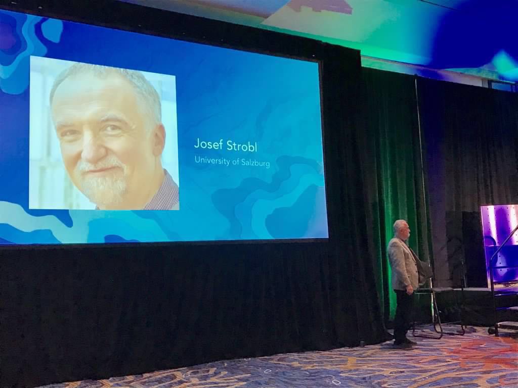
UNIGIS participó en el panel Educación, "Keeping Up with Accelerating Change at  Education GIS Conference 2017" gracias a la representación de Josef Strobl, líder de UNIGIS International, quien abordó la temática: Students Mapping for Sustainable Development at Education GIS.  También en el ámbito de Educación, Richard Resl, Director de UNIGIS América Latina presentó a los asistentes el "MOOC for local GeoExperts How to Empower Citizen", el cual contó con una gran acogida.

En el marco de la Esri UC, UNIGIS celebró también el encuentro con su comunidad de colegas de la red internacional y egresados, con quienes anunció el lanzamiento del nuevo nodo regional UNIGIS Américas, que atenderá al público hispanohablante, presente en Canadá y Estados Unidos.  Con esta expansión en Las Américas UNIGIS continuará su misión de fortalecer el aprendizaje en la Geoinformación y SIG, a através de los servicios académicos certificados por la Universität Salzburg, Austria.

Conozca la agenda de la Esri UC, reviva los momentosmás importantes del evento y visite nuestra galería de imágenes

Le invitamos también a participar del Foro mundo UNIGIS 2017 desde el nodo de su preferencia ¡Bienvenidos!

"Creamos la Comunidad SIG más activa en América Latina".
===================
Síganos en las redes

https://twitter.com/UnigisALatina